Foreword #
“Change alone is eternal”

The universe and its beings are ever-changing. Nothing here lasts forever, except change. As the inhabitants of the universe, this applies to us as well. We as human beings are responsible for an innumerable number of changes ourselves. Every single act of ours triggers a chain of events. Some are intentional and most are unintentional and even remain unnoticed.
Some such changes gain prominence because of the significant chain of events it triggers. Prominence to such an extent where fellow earthlings find it amusing and interesting to know about them. We humans have taken great efforts to cumulate, analyze and understand such prominent changes and render it as a subject called history.
The proper understanding of history sharpens our perspective of understanding the world around us. We begin to look at history as a discipline and understand its role in sculpting the world that surrounds us. In this process, we tend to realize that we are the outcome and makers of history ourselves. We live in a world which is the result of several past events. We are the creators of the ones to follow.
This is a point of view where time becomes our mentor. It reveals itself to us and enables us to sense its flow in everything. It stands by us during the process of understanding the world that surrounds us. It guides us through everything we see. It narrates tales we ask for. This is one such tale. A tale by time and a tale through time.
Introduction #
We humans are not solitary in nature. From our earliest days on this planet, till today, we have always lived together as groups and satisfied our needs by working as communities.

Over the different phases of the human evolution, the structure of these groups and communities have changed with respect to the priorities and fundamental ideas which carved their foundations. During the times when humans were hunter-gatherers, the communities were mostly nomadic, whereas after the discovery of agriculture, communities became more stable, settled down in one place and diversified.
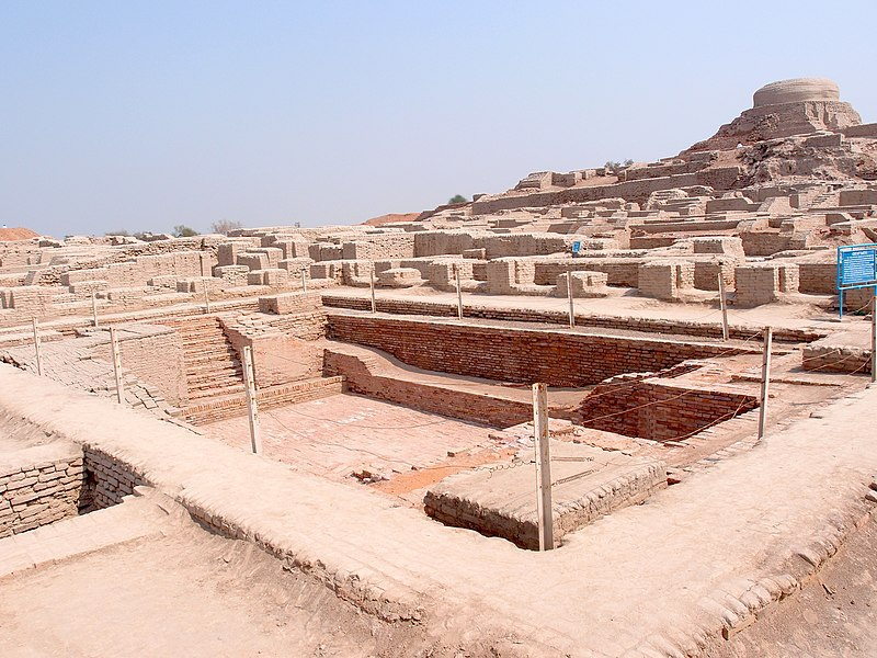
By then, areas which were suitable for both hunting-gathering and agriculture became spots where mankind started to flourish. Hunting tribes who had stationed themselves because of the abundance of food, had by now become vast communities of cultivators. In such regions, humans did not merely survive. They evolved, flourished and thrived. Along with the community flourished its cultures, art forms, cuisines, practices, ideologies, technologies, together creating massive civilizations. Indus Valley, Egypt, Mesopotamia are some well-known examples of such civilizations on this planet.
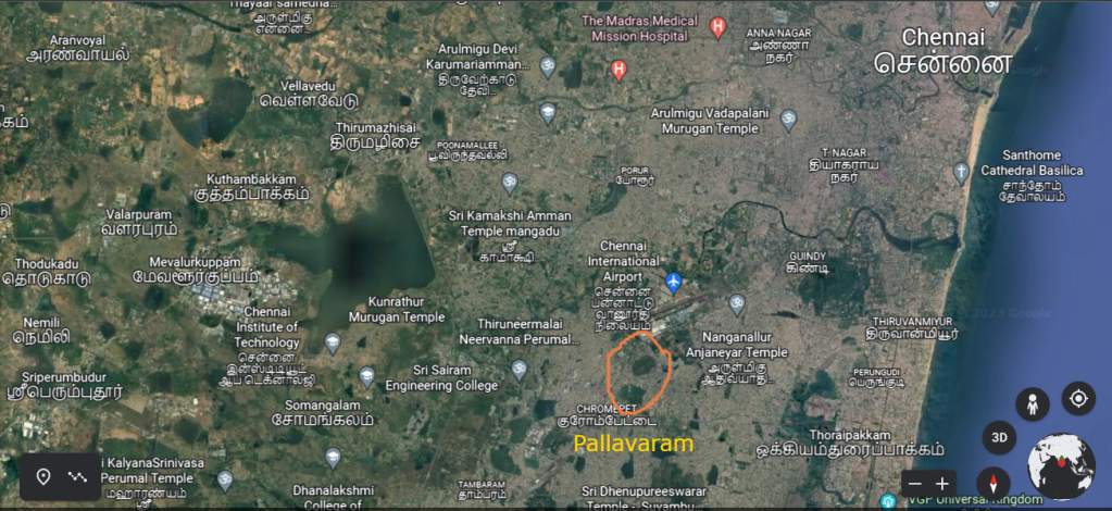
Pallavaram seems to have been one such place. Its scale may not find itself on par with the earlier mentioned examples. However, it remains as a spot where we humans have settled down from our earliest days on this planet.
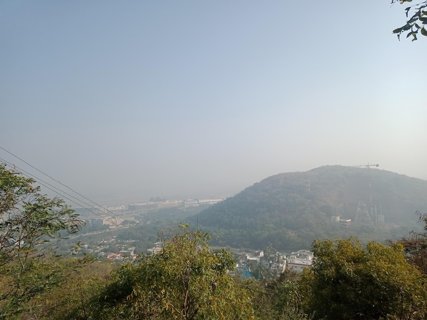
Situated in the south Indian city of Chennai, this town is eminent today, in several aspects. It can be attributed for preserving the cultural richness and the diverse landscapes of the Chennai city. It is one of the very few places in the city where you can find crowded markets to secluded spots, rows of skyscrapers to elegant hillsides, buzzing traffic to deserted streets, highways to off-road tracks, gated communities to isolated forests, congested colonies to scenic high-grounds, active quarries to silent settings and airports to railroads. Ask for any ambiance and Pallavaram bestows it upon us. Such is the affluence of this town.

However, the prestige of Pallavaram rests elsewhere. It lays in the monuments and events that weave the rich history of this place. It rests in the events that have shaped the town we experience today. It lays in the tale the town tells us about itself, its surroundings and we humans who associate with it.
As we begin to uncover this tale, we tend to sail back in time to different epochs of history. In the process we analyze the different fragments of the timeline and understand its role in shaping the prestige of Pallavaram.
As we begin to uncover this tale, we start our journey from a stone and listen to the history it narrates.
Chapter 1: The Story of a stone #
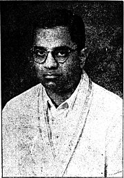
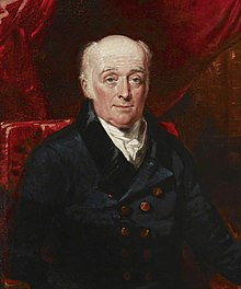
We commence our journey on the 26th of December in the year 1858, the day when a young geologist named Robert Bruce Foote started his career at the Geological Survey of India (GSI).
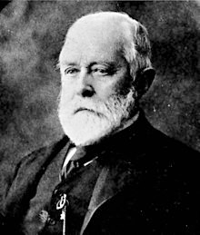
His first posting was at the Madras presidency and the majority of his tenure was spent in peninsular India. His days with the GSI resulted in laying a large foundation for the study of Indian archeology. He was a pioneer in that field and his contribution cannot be ignored when it comes to study of any aspect of Indian archeology. Till today, archeologists, geologists and historians are grateful for his work and admire his dedication and his clean and tidy documentation. Indeed, he is worthy of the title “The father of Indian Archeology”.
However, it is quite impossible for Bruce Foote to be aware of any of this during the early days of his career, unless he had some psychic powers. It wouldn’t be surprising if he possessed them too because his colleagues and scholars describe him to be a man of many interests and talents.
Foote joined the GSI substituting geologist H. Geoghegan after his demise, for field work at Tiruchirapalli. For the next five years, Foote served as an assistant geologist in several other field works in various areas of the Madras presidency under renowned geologists of his time.
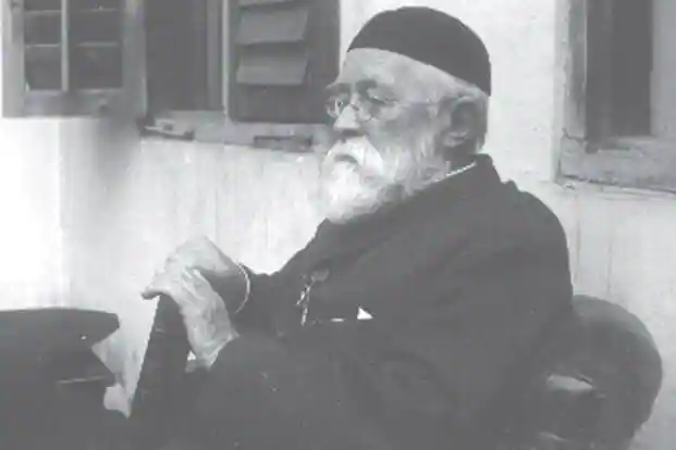
Researches and records about Foote create an imagery that he was an intuitive man who admired the landscapes, culture, heritage and history of the Indian subcontinent. He and his first wife Elizebeth would spend their leisure time painting the various landscapes of India and studying about its history.
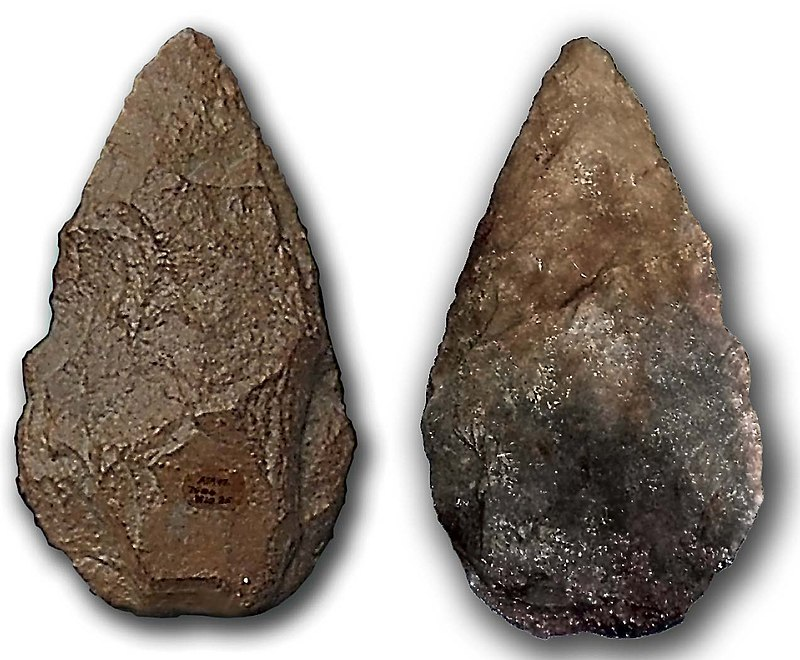
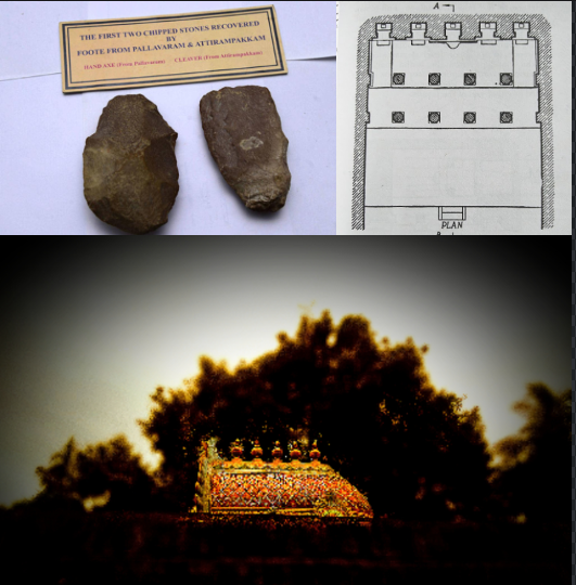
On May 30th 1863, Foote stumbled upon a stone hand axe which belonged to the Paleolithic period in a pit while examining the charnockite mines at Pallavaram. The hand-axe did not require Foote’s efforts to unearth it as it was lying on the surface of a shallow pit. It was as though the axe had been waiting to catch Foote’s sight.
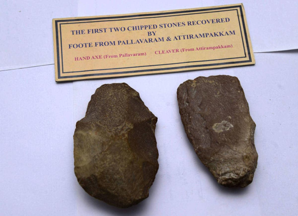
This event of Foote’s coincidental discovery of a Paleolithic hand axe cannot be ignored in the study of Indian archeology as it was one of the first few prehistoric antiquities to be unearthed in India. Later the same year, Foote along with his colleague from the GSI, William King discovered similar Paleolithic stone tools at Attirampakkam which is a town situated in the outskirts of the present-day Chennai city. In the same year, he also published his first formal research paper about these discoveries. He himself admits in this paper that his knowledge in the field of archaeology is very peripheral and is restricted to an Archeology hand book. Yet, his observations are surprisingly accurate.
He compares these tools with those unearthed by his contemporary archaeologist Joseph Prestwich on the banks of a lake in England. He guesses that both these sets of tools might have belonged to comparable periods because of their similarity in their in polishing and shape. Foote’s wife Elizebeth, who helped him with the illustrations for his paper, had nicknamed the hand axe from Pallavaram as a “shepherd”. Her illustrations in the paper are very helpful for us to understand the similarities between the stone tools from Madras and those unearthed in England.
Both these sets of hand-axes are bifacial. In this sense, these hand-axes have two broad striking surfaces. Bifacial hand-axes are the largest known tools used by humans during the Paleolithic period. Even in the technical aspect, this coincidental piece of discovery was rare. It being one of the first prehistoric antiquities to be discovered in the Indian subcontinent, it is a sophisticated discovery indeed.
These discoveries by Bruce Foote and William King at Madras became a sensation immediately, because the paper was published during a period when intriguing questions about prehistoric antiquity and ancient humans were very widely raised in the west. Consequently, the discovery of prehistoric antiquities in India was a surprise for the people of the west. This resulted in Foote’s paper being put to a wide range of criticism immediately after publishing. All these together surged the fame of Bruce Foote and the Pallavaram region as well. Towards the end of the 19th century, it started attracting a wide range of tourists from the west who came to admire and examine this region.
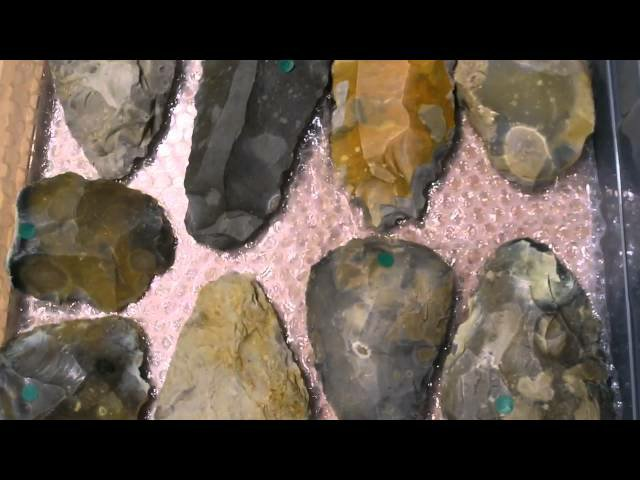
The hand-axes discovered at Pallavaram and Attirambakkam are termed as the “Madras Hand-axe Industry ” or the “Madras Stone Axe Industry ”. Prehistoric hand-axes, microliths and cleavers discovered at other sites, which belonged to the same period of the tools discovered at Chennai are classified under the division called the Madrasian culture. If one refers to a prehistoric artifact as part of the Madrasian culture, we can infer that it is part of the lower Paleolithic period, roughly about 2.5 million years ago. This was one of the earliest phases of human evolution on this planet.
The tools discovered at Attirampakkam went through a scientific process of dating method known as the Cosmic ray exposure dating. The results of this process confirmed that these tools were more than 1.5 million years old. During the time of its discovery, these artifacts joined an elite group of the oldest artifacts to be discovered on this planet.
The 30th of May 1863 was not just a big day for Foote but also a day when a spectacle was discovered and the history of the Indian subcontinent was redrafted. Later in the year 1906, Foote’s family sold these tools to the Madras Museum (presently known as the Egmore museum), until which time these remained in his personal collection.
During the years of Foote’s tenure with GSI, several attempts were made to deduce the Madras that existed during the times when the makers of the hand axe roamed these lands. Most of those deductions were inaccurate because of the lack of knowledge about prehistoric India. People then had not witnessed the phenomenal structures of the Indus Valley civilizations nor had they known about the intricate technologies of Keezhadi. Therefore, it is natural for them to assume that India’s history was very primitive until their arrival.
Today, our knowledge about prehistoric India is comparatively vast and sophisticated. Therefore, we can assume that our deductions are far more accurate. In this world of uncertainty, how can one consider a mere deduction to be certain and accurate?
Humans are not solitary in nature. We can observe that our boundaries and colonies have always been established in such a way that we live together and satisfy our needs by working as a community. However, our needs and notions have advanced with time and our priorities have stayed accordingly. Such priorities are the key factors which have shaped our homes and our society at large.
Before we attempt to deduce the structure of the community which lived in Pallavaram, we must understand the abstract ideas and priorities that shaped their lives and their settlements.
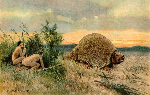
The makers of the hand-axe belonged to the greater Paleolithic period , when humans were mainly hunter-gatherers who constantly moved their settlements. They followed the trails of the animals which they hunted for food. Their settlements lay on these trails. Therefore, the major idea of the community then, was to move along with the food and station themselves at places where it was abundant. Pallavaram seems to have been one such place.
Following Bruce Foote’s finding, several other stone tools and prehistoric artifacts have been accidentally discovered in and around Pallavaram. Several instances like, finding stone tools while digging the backyard, finding prehistoric artifacts while digging for the basement for construction, finding antiquities at mines, etc have been recorded over the years. This tells us that a group of people, probably a tribe, were settled in this region for a decent span of time.
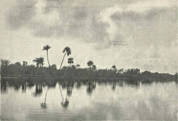
The dense and fertile forests would have provided them with abundant food to aid their hunger and the Periya Aeri, Pallavaram and the Adyar river would have been their perpetual water sources. What more would a tribe need when a place provides them with abundance of their necessities.
However, Bruce Foote was one of the first modern scholars to have spoken about the prehistoric aspect of Pallavaram and of Madras as well. It is indeed fascinating to visualize a man with no intentions, who coincidentally discovered the remains of one of the earliest inhabitants of the Chennai city and the earliest tribes who wandered the lands of the Indian subcontinent.
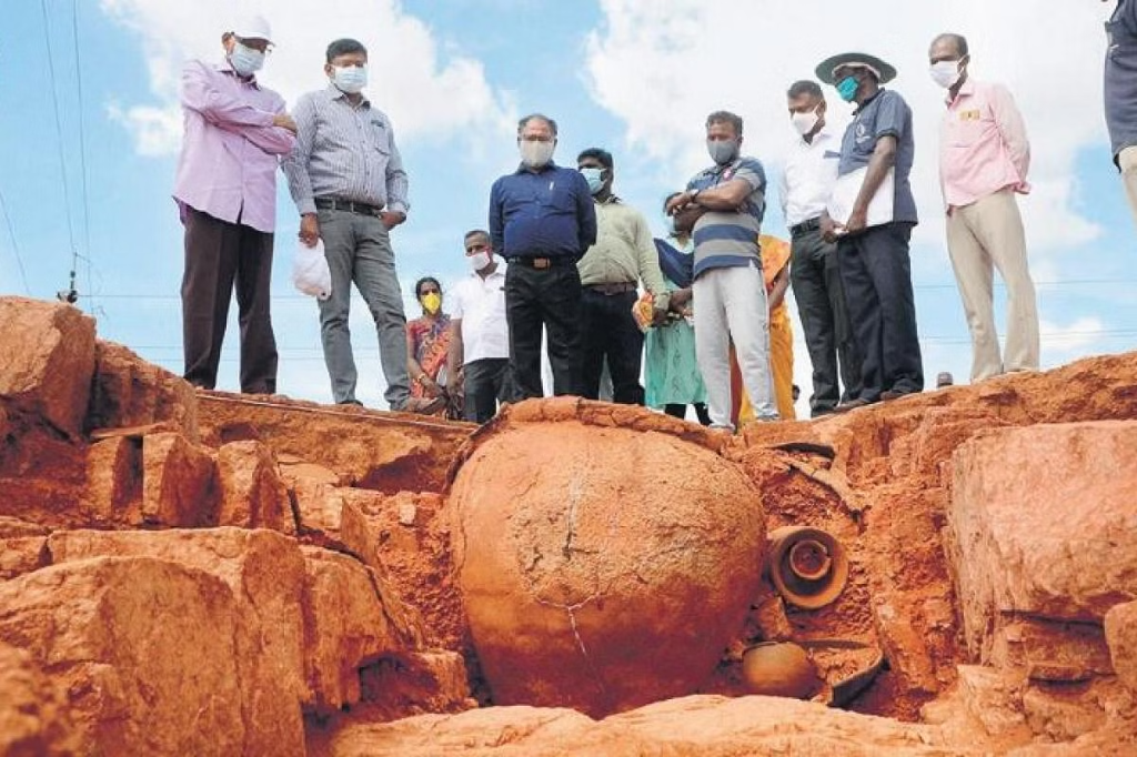
The prehistoric tales of Pallavaram do not end with the hand axe alone. In fact, it starts here. As suggested earlier, several other prehistoric antiquities were unintentionally uncovered in this region. The hand axe was the first and probably the oldest of the list. One prominent discovery that accompanied this was that of a Muthumakkal thazhi or a burying urn near the Old Pallavaram area, The urn was just 10,000 years old and was part of the Megalith culture of prehistoric antiquities. Several small tools which were less than 10,000 years of age were also unearthed in this region. This confirms that from the early Paleolithic era to dste, Pallavaram has been a place where humans have flourished and thrived.
Even after the discovery of several prehistoric antiquities in Pallavaram, no major efforts have been taken to carry out a full-scaled excavation project. The officers of the archeological department complain that the residents and the mining companies at Pallavaram are against the setting up of an excavation site in that locality. It could be because it may interfere in their day to day activities. We hope one day these oppositions will subside and we bring to light several prehistoric antiquities and understand ourselves better.
Throughout prehistory and history, Pallavaram has had a significant human connection to it. As we sail down the timeline to understand and analyze this connection, our next stop is at the Pallavan Era, the phase of history when establishing tech cities was a trend.
Chapter 2: The Pallavan Pinnacle #
Introduction #
The Pallavas have made innumerable contributions to the field of temple architecture and arts. The study of South Indian temple architecture will be incomplete until the proper understanding of the Pallavan influence. Temples built during their rule were not stereotypical. They gradually mastered the techniques and methods of constructing different types of temples and attained a certain level of excellence and artistic aesthetics.
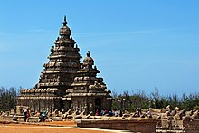
The town of Mamallapuram is probably the most accurate example of this. It hosts monuments and temples which are some of the pinnacles of the Pallava architecture and Indian temple architecture as a whole. The monuments of this town are benchmarks which showcase the mastery in the fields of architecture, engineering and sculpting.
Yet, even the most grandest cities have a few fundamental ideas which shape and hold its elements together. As we trace the idea back to its roots, we tend to delicately dissect and analyze each and every element and feature.
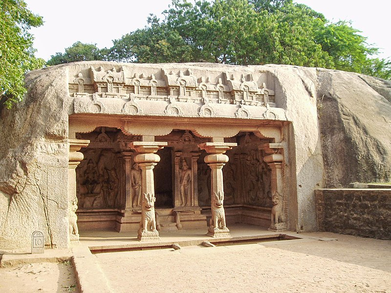
Cave temple at Mamallapuram which was excavated during the reign of Mahendhravarman 1
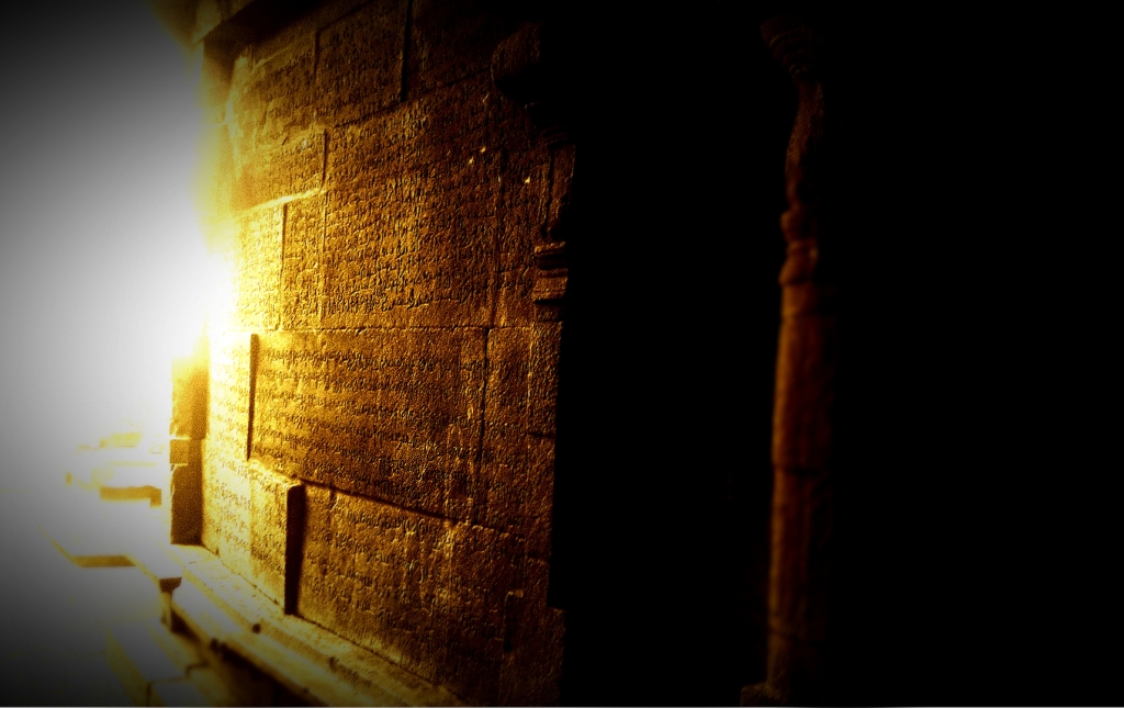
In this chapter, we are going to trace and analyze the evolution of the rock-cut temples of the Pallavas and understand the position of the Panchapandava temple at Pallavaram, in this hierarchy.
The Pallavan Pinnacle #
We are now in the late 5th century CE, the period when the Kalabhras who were ruling the majority of southern India were gradually declining. The foundation of their kingdom was greatly damaged by the Pandyas who won them to regain their capital of Madurai. Subsequently, Simhavishnu, the Pallava emperor of that time, considered this to be the perfect time and declared war against the Kalabhras. He won the battle comfortably and regained his territory which was spread till the banks of river Cauvery.
The Kalabhra’s consecutive defeats against the Pandyas in the south and the Pallavas in the north had shrunk their territory to a great extent. They became feudatories under the Pallavas. The landmass of Tamil Nadu had regained its ancestral rule. Yet, the Kalabhran influence on it remains un-erased because wars change the rulers, not the people.
Jainism and Buddhism flourished in Tamil Nadu under the Kalabhra rule. Several chaityas and viharas were established and a large number of people under the royal patronage followed and preached these cults. This led to the fusion of ideas in the local practices and the new cults, which resulted in the creation of several fresh customs, cultures, practices, ideologies, mythologies, literature, art forms and architecture. Even after the decline of their patrons, these cults continued to flourish in the south of India.
During Simhavishnu’s time, his territory was filled with a variety of cults, practices, ideas, cultures and culture-scapes. Thus the vast lands under the Pallavan rule underwent a transformation. New emperors with new policies made several changes to the society. Together, this period became an era when fusion and mass transformations amended the people of southern India.
After Simhavishnu, his son Mahendhravarman 1 ascended the throne. Pallava inscriptions address Mahendhra with the title of “Vichitra Chithan ‘‘ meaning one with a unique thought process. True to his titles, his interests lay far from the battlefield. He was passionate about temple architecture, art forms and sculptures. During his reign, several new temples were built in the Thondaimandalam (Northern Tamil Nadu and Southern Andhra Pradesh) region. He is also credited for establishing the earliest structures of the dreamland of Mamallapuram.
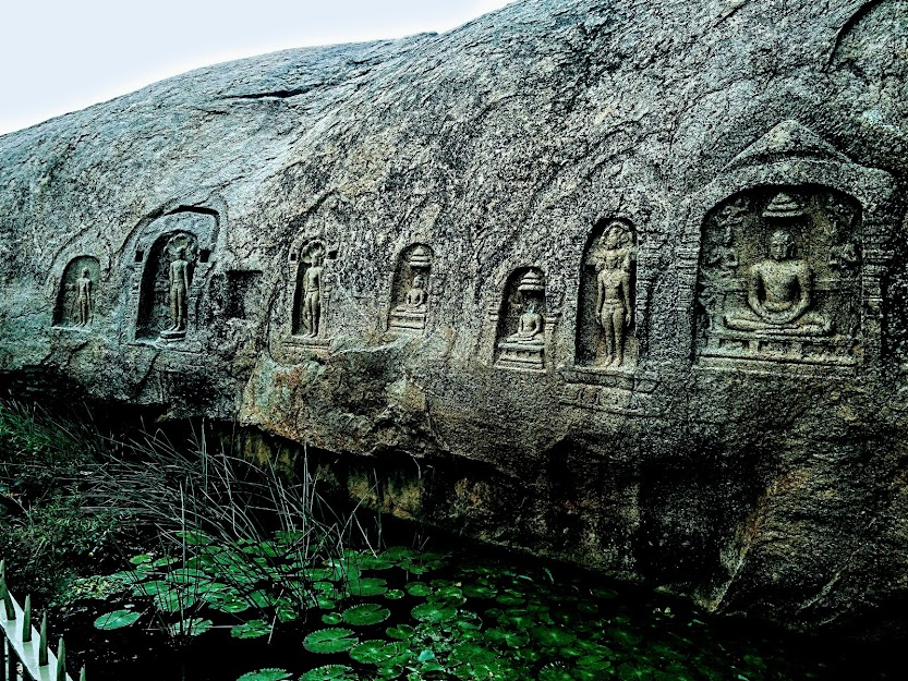
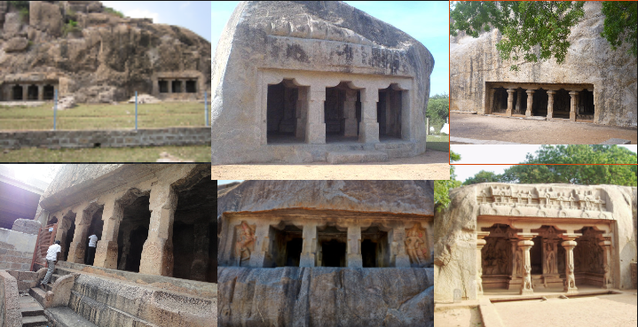
Mahendhra period temples were mostly rock-cut temples i,e cave temples or குடைவறை கோவில் (in tamizh). Mandapas and shrines had to be excavated from boulders and hillocks to create this type of temple. The Malakottai cave temple, Tirichy and Thirumayam cave temple, Pudukkottai are fine examples of rock cut temples or குடைவறை கோவில்.
The temples built during Mahendra’s rule greatly resemble the Jain and Buddist cave temples of that time. The pillars, Mandapas, shrines, sub shrines, niches and its decorations are some key features which exhibit this similarity. Yet the temples built under his patronage stand unique because of its improvisations, decorative motifs, deities, and the grand iconography of sculptures that decorated its walls and pillars.
Pallavaram, Seeyamangalam, Thiruvallam, Mammandur, Thalavanoor, Thirukkazhukundram, Mandappattu, Singavaram, Mahendhravadi, Thircharapalli, Namakkal and Sithannavasal are the rock-cut temples built by Mahendhravarman.
Historians are able to trace the evolution from a basic layout of a jain temple to the Mahendravarman’s style of cave temple architecture. This evolution is evident as we observe the pictures on the screen ranging from the basic caves at Mamandur to the grand hallways at Mamallapuram. All these monuments were built during the period of Mahendhra’s rule. It is fascinating to observe how small chambers with plain pillars have evolved into majestic cave temples with panels of sculptures, pillars adorned with fine chisel work, broad chambers hosting the deities along with the Dwarapalakas guarding them and patterns that decorate the walls.
But, as admirers of the historical significance of Pallavaram, our connection to this hierarchy is very faint and unclear. It is time we draw the connection between the Pallavan hierarchy and Pallavaram.
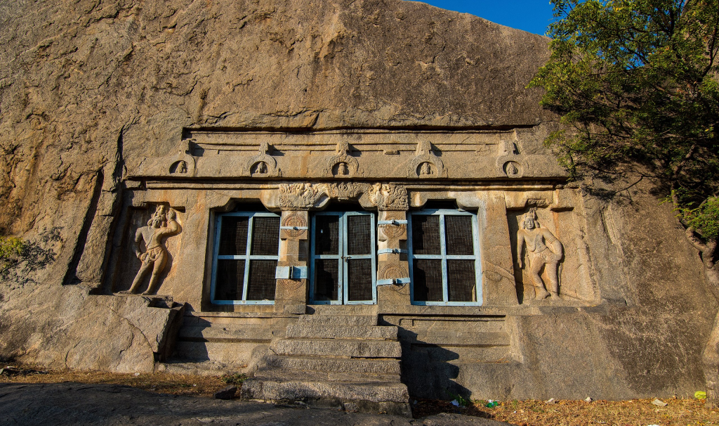
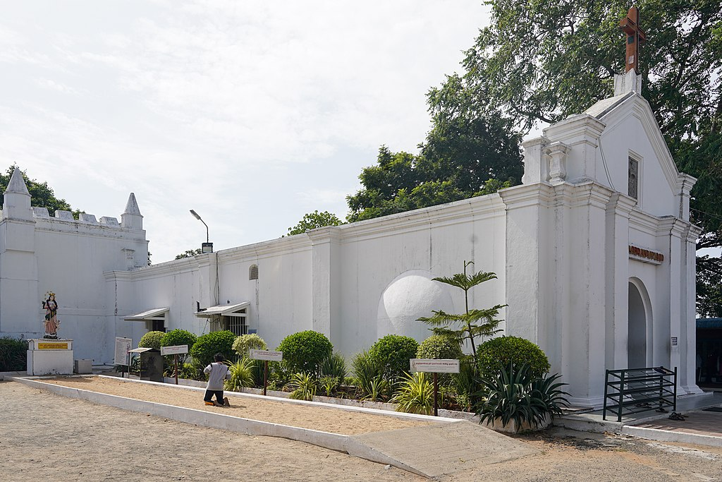
From the 6th century onwards, Pallavaram and the Pallavas have had an inseparable bonding which lasted for almost two centuries. This reflects in the very name, Pallavapuram which has now become Pallavaram. During the reign of Mahendhravarman, Pallavaram seems to have been a major town in the Pallava territory. A large population of people seem to have lived in this region.
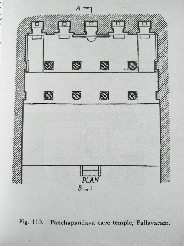
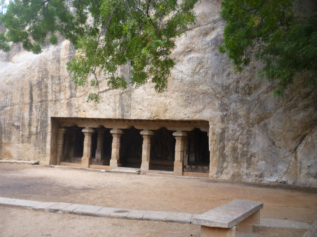
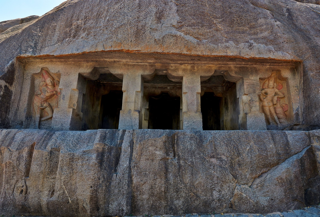
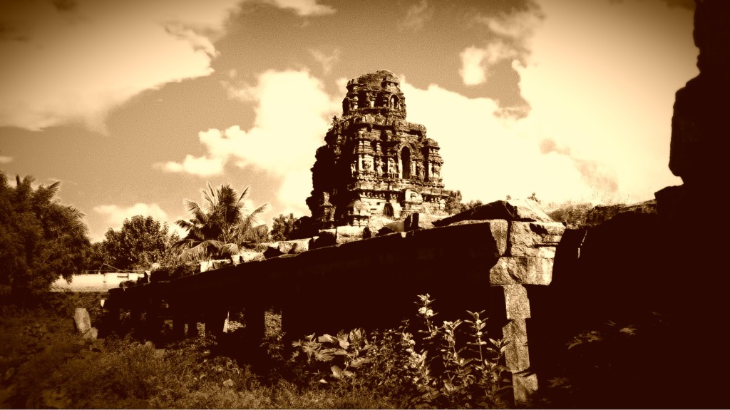
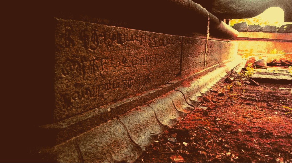
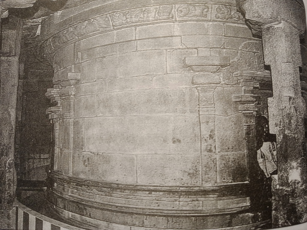
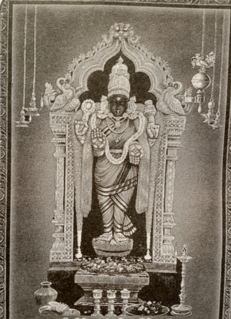
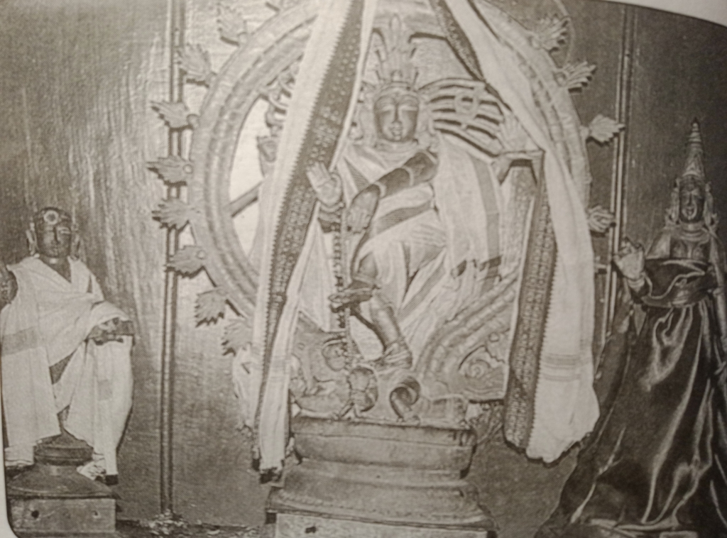
In these years Mahendhra built the Panchapandava cave temple near this town on a small hillock. It is five celled and is situated in the slope of the hillock. The typical Mahendhran style pillars hold this monument upright. The monument is 24 feet long and 12 feet wide. Some Mahendhravraman period inscriptions are found near the ceiling. Due to later renovations, the inscriptions have been heavily damaged, making it almost impossible to read it.
Apart from these, every other detail we know about this temple today, are mere assumptions and there is no clear evidence in favor. This is because the temple is no longer dedicated to Shiva, Vishnu or Brahma as one expects. For centuries, Allah has been residing in this shrine and has transformed the space into a compact and beautiful Dargah. In this process, the fine details of the Mahendhra period temple have been covered by the later constructions for the Dargah. This makes it impossible for us to understand the structural details of the monument.
However, by observing and analyzing other Mahendhra period temples, historians are able to assume the details of this temple. Since the temple is five celled, a few experts assume that the three central shrines would probably have hosted the images of the Trimurthis (Brahma, Vishnu and Shiva) and the cells in the corners would have borne the images of the Dwarapalakas. Whereas, Dr. M.Rasamanickanar mentions in his book (Pallavar Varalaru), this temple under the list of Shiva temples built by Mahendhravarman.
The details about the designs and motifs that adorned the walls and pillars of this monument are yet to be uncovered. The temple and the hillock in which it is situated are addressed as the Panchapandava temple and the Panchapandava hill respectively. There are no clear historical records that justify the reason for this name. Some historian address this monument as the Pallavaram cave temple or the Pallavapuram cave temple.
Apart from all these historical details and architectural significance, the importance of this temple is the history it stands as testimony. In the context of the Pallavaram region, this monument is an identity to its rich human connection over the wide span of the timeline. From the earliest eras of human evolution, till the present, we humans have had a notable connection with this area.
The reason behind this remains unchanged till today. Pallavaram is a region which provides us with an abundance of our basic requirements. Large spans of rich and fertile forests, perennial water sources, structure of the landmass are some major reasons that make this region ideal for human settlement. As we observe closely, such places on this planet have always been the hotspots where our human race evolved, flourished and thrived.
From our earliest days on this planet till the riegn of Mahendhravarman, Pallvaram has not lost its significance in history. This legacy continues till today. As we proceed on our journey through the timeline, with the motive of understanding the historical significance of the Pallavaram region, our next stop is during the reign of the great Chozha emperor, Kulothunka Chozha 1, a period when the southern parts of the Indian subcontinent were flourishing under the golden era of the mighty Chozha dynasty.
Chapter 3: The Chozhan Spectacle #
Introduction #
The Chozha empire is a proud member of the moovendhar (the three kings) of south India alongside the Chera and Pandya. This dynasty is arguably the largest of them all, in terms of territory and ruling time-span. The Chozha kings are widely admired for setting high standards in the fields of politics, warfare, arts, architecture and governance. Their contributions to the above mentioned fields have become study materials for its successors and testimonies for the rich history of the Indian subcontinent.
Most historians agree that the Chozha empire attained its golden era under the rule of the great Rajaraja Chozha 1, and lasted till the end of reign of Vikrama Chozha 1. During this period, the Chozha empire stretched from Sri Lanka to the southern banks of the river Ganga. Several islands in southeast Asia were also under the rule of the Chozha kings.
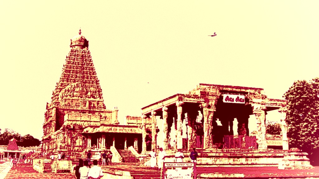
Apart from the expansion of the territory, several magnificent temples were also built. Rajaraja 1 built the magnificent Peruvudaiar temple at Thanjavur and his son, Rajendhra Chozha 1 built its competitor, the Gangaikondachozhapuram temple situated in the Ariyalur district. Both these temples are considered as the hallmarks of South Indian temple architecture.
After Rajendhra’s demise, his son Adhirajendhra Chozha 1 became the next Chozha emperor. His rule did not last long due to his untimely demise. After him Kulothunka Chozha 1 ascended the Chozha throne. He revived back the kingdom after the loss of its previous emperor and re-established the authority and the lost glory of the dynasty amongst its contemporaries. Following the rule of Rajaraja and Rajendhra, Kulothunka made it possible for the golden era of the Chozha empire to prolong.
Kulothunka’s rule was unique compared to the other two great rulers of his period. He mainly focused on establishing authority and proper administration over the vast extents of the newly captured territories. Constructing new temples, drafting new policies for taxes and rights over land and regulating the distribution of wealth to the benefit of the citizens seems to have been the major agendas of his rule.
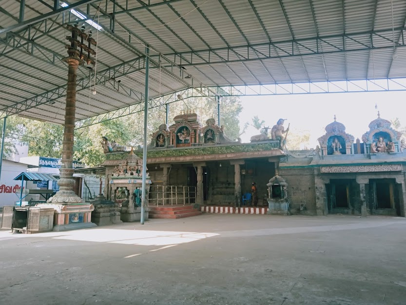
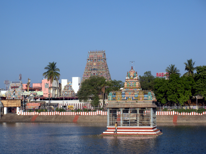
In all these aspects, Pallavaram and its neighboring regions have been beneficiaries. Under the reign of Kulothunka Chozha 1, the spectacular Thirusoolanathar temple was built here. The inscriptions on the walls of this monument host some key details regarding the policies that were implemented in this region during the time of its construction. In this chapter we shall look into the details of the Thirusoolanathar temple, its inscriptions and the Pallavaram that might have thrived during the time when these were freshly made.
The Chozhan Spectacle #
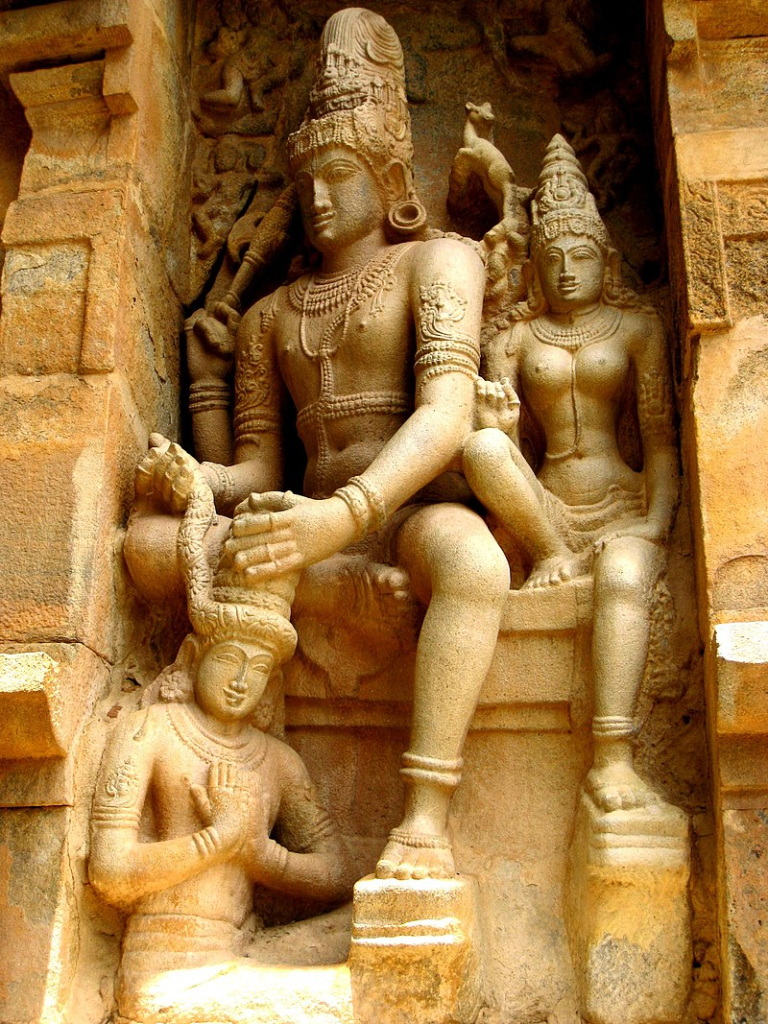
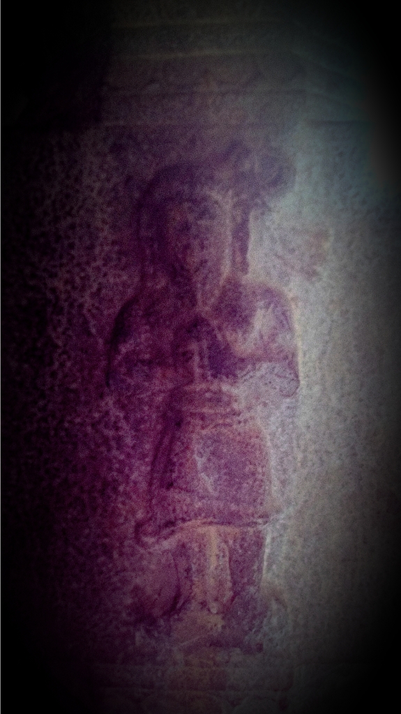
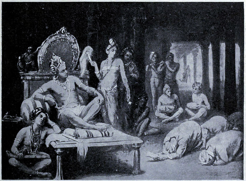
Rajendhra Chozha 1 represented as Chandikeshwara, being adorned with a garland by Lord Shiva and Parvathi. Panel sculptures from the Gangaikondachozhapuram temple, Ariyalur District, TN
We begin in the late 10th century CE, when the vast lands of the Chozha empire had lost its noble emperor, Rajendhra Chozha 1. He was a mighty Chozha king who is credited for expanding the Chozha territory to almost twice the area that was handed over to him. Before his reign, his father, the great Rajaraja Chozha 1 was also instrumental in conquering several new kingdoms and transforming the Chozha dynasty into a very powerful kingdom in southern India. Rajaraja’s rule also marked the beginning of the golden era of the Chozha empire.
In less than a century, the Chozha kingdom had drastically grown in area and power. For the successive rulers of this territory, even to sustain such a large kingdom might have been a colossal task. The contemporary empires of that period who lost their territories to the Chozhas, were awaiting an ideal opportunity to invade and re-gain their shares of the kingdom.
Subsequently, after the demise of Rajendhra Chozha 1, his son and the rightful heir to the Chozha throne, Adhirajendhra Chozha was crowned as the next Chozha king. Unfortunately, his rule did not last long due to his untimely demise. The Chozha kingdom had lost its second emperor in just a span of six months. Unlike the previous episode, this time the emperor had passed away leaving no prince in waiting.
Confusion spread across the Chozha kingdom and the stability of the mighty empire was greatly shook. This gave the opposing rulers an ideal chance to invade the Chozha territory and conquer their shares of the kingdom. All these factors together made the Chozha dynasty extremely vulnerable. Almost half the landmass of the present day Indian subcontinent had yet again lost the apex of its administration.
The ministers and the senior officers working for the Chozha dynasty, who were well aware of the situation that prevailed in their kingdom, decided that the Chalukyan crown prince, Rajaraja Narendhran will be crowned as the next Chozha emperor. Rajaraja Narendran was Rajendhra Chozha’s daughter’s son (Adhirajendhra’s sister’s son). He ascended the Chozha throne with the title as Kulothunka Chozha 1 and ruled the longest among the Chozha kings (1061-1118).
As the new Chozha king, Kulothunka had to regain the lost stability of the empire and re-establish the political authority of the mighty Chozha dynasty among the contemporary empires. The unexpected and untimely loss of Adhirajendhra Chozha within a short period after ascending the Chozha throne, had added extra pressure on Kulothunka.
As mentioned earlier, for any average emperor, even to sustain such a large empire and protect it from invasions must have been a massive task, but Kulothunka had achieved the mentioned tasks successfully and made it possible for the golden era of the Chozha kingdom to extend, even after his rule. The process through which he had regained the stability and the political authority of the Chozha kingdom shows his mastery and excellence as an administrator.
Kulothunka modified temples into regional administrative centers. Under his patronage, several new temples were built in the Chozha territory. The walls of these temples were inscribed with the details regarding the policies which were implemented in the particular regions. These policies were mostly concerned with the regulation of agricultural processes, enhancement of cattle rearing, regulation in paying the salary to the local administrative officers and temple officials, distribution of government wealth and property to the local people, process of land registration in that particular region, taxation and its regulations, exemption of taxes for certain transactions, sourcing essential supplies for the temple and its garden, etc.
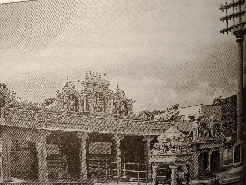
The Thirusoolanathar temple near Pallavaram is one of the temples built and established during the reign of Kulothunka Chozha 1. The temple is situated in Thirusoolam, the town which presently shares its Municipal corporation boundary with Pallavaram. During the time of Kulothunaka, all these areas were together know as the Pallavapuramana Vanavanmaadhevi Chaturvedhimangalam, as mentioned in one of his inscriptions.
Thirusoolam was once a village situated in the other side of the Pallavaram hill and was surrounded by three other hills. It was a fertile landmass surrounded by hills, which anchored dense forests, making it an archetypal region for agriculture and cattle rearing. Today, it is a small dusty town amidst loud, active quarries.
The inscriptions in the walls of the Thirusoolanathar temple address the Thirusoolam and Pallavaram region through several names in Tamizh and Samskrutham, i,e Pallavapuramana vanavanmaadevi chathurvedi mangalam (பல்லவபுரமான வானவன்மாதேவி சதுர்வேதி மங்களம்), Jeyankonda Chozha mandalathu puliyur kottathu kulothunkachozha valanattu surathur naatu thiruchuram (ஜெயங்கொண்ட சோழ மண்டலத்துப் புலியூர்கோட்டத்து குலோத்துங்கசோழ வளநாட்டு சுரத்தூர் நாட்டு திருச்சுரம்), thiruneetruchozhanallur (திருநீற்றுச்சோழநல்லூர்), thiruchuram (திருச்சுரம்), thirisoolam (திரிசூலம்), bhramapuri (பிரம்மபுரி) and thirusoolam (திருசூலம்). Each of these names carries in itself anecdotes to the history of the region of Pallavaram and Thirusoolam.
Pallavapuramana vanavanmaadevi chathurvedi mangalam (பல்லவபுரமான வானவன்மாதேவி சதுர்வேதி மங்களம்): – Language; Tamizh and Samskrutham)) This name is prevalently used in the inscriptions dating back to the early period of Kulothunka’s reign. Pallavapuram seems to have been the name used to address this region till then. Vanavanmadevi is the name of Kulothunka’s grandmother (the royal queen of Rajendra Chozha 1). The term Chathur vedi (Samskrutham) literally translates to four vedhas. As mentioned earlier, the town of Thirusoolam is surrounded my four hillocks. The sthalapurana of the Thirusoolanathar temple mentions that these four hillocks represent the four Vedhas, namely Rig, Yajur, Sama and Atharvna. Thus, the majority of scholars infer that the term chathurvedi refers to the four hillocks surrounding the town of Thirusoolam. On the contrary, some scholars consider that the term chathur vedhi denotes the men who have mastered the four vedhas (vedhiyar: – வேதியர்). In this case, we can assume that, during the rule of Kulothunka, the town of Thirusoolam must have hosted a considerable amount of vedhiyar. Mangalam is a general term prevalently used in the inscriptions to denote an area or town.
Jeyankonda Chozha mandalathu puliyur kottathu kulothunkachozha valanattu surathur naatu thiruchuram (ஜெயங்கொண்ட சோழ மண்டலத்துப் புலியூர்கோட்டத்து குலோத்துங்கசோழ வளநாட்டு சுரத்தூர் நாட்டு திருச்சுரம்): Language: Tamizh)) This name is used in formal and administrative inscriptions. It refers to the town of Thirusoolam through the hierarchy of administrative land divisions followed during that period. It begins by referring to the victorious Chozha kingdom, followed by the term Puliyur kottam. The idea of sub-division of land as kottam (wards) was first introduced by the Pallavas but the Chozha emperors are widely credited for using it prevalently. The Puliyur kottam refers to the regions that constitute the majority of the present day Chennai city. Areas such as Koyambedu, Poondamalli, Saidapet, Pallavaram, Alandur, Eekattuthangal, Aadambakkam were all denoted by the term Puliyur Kottam. Following these terms, Kulothunka Chozhavalandu refers to the prosperous Chozha territory in terms of its ruler at the time of the inscription’s first draft. Thus, we can infer that the inscriptions bearing this name were drafted under the rule of Kulothunka. Surathur nadu refers to a specific region under the Puliyur Kottam. Finally, Thirchuram is the name of the particular town.
Thiruneetruchozhanallur (திருநீற்றுச்சோழநல்லூர்): – Language: Tamil)) Thiruneetruchozhan was one of the names of Kulothunka Chozha 1. A Kulothunka period inscription in this temple mentions that during his rule, the official name of this town was changed from Vanavan Madevi chathurvedi mangalam to thiruneetruchozhanallur.
Thiruchuram (திருச்சுரம்): – Language: Tamizh)) This seems to have been one of the spiritual names of Pallavaram. Churam (Tamizh) translates to valley or land surrounded by mountains. This name refers to Thirusoolam as a landmass surrounded by mountains with the thiru (meaning: holy) prefix added for respect.
Bhramapuri (பிரம்மபுரி): – Language: Samskrutham)) According to the sthalapurana of the Thirusoolanathar temple, Lord Bhrama commenced his duty of creation after praying to the deity residing in this temple. It is mentioned that he first created the four hillocks representing the four vedhas and then created the rest of the cosmos. Thus, the town of Thirusoolam is also addressed as Bhramapuri. The deity of this temple is also referred as the Bhrampureeswarar.
Thirusoolam (திருசூலம்): – Language: Tamizh)) is the name of the town that is used till today. Most scholars consider this to be the abbreviation of the term Thiruchuram.
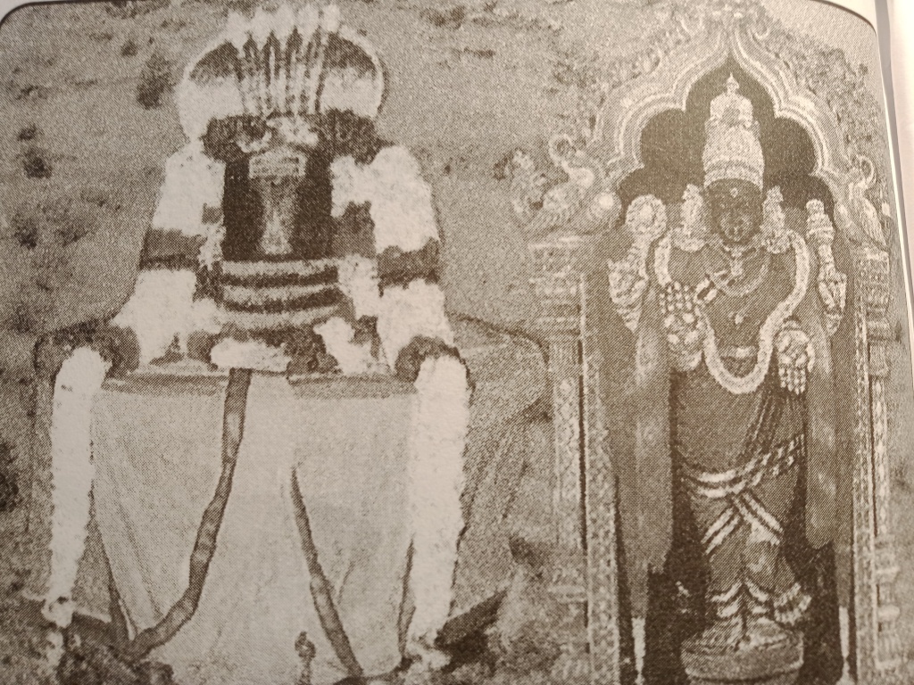
The main deity in this temple is in the form of a Shiva Linga and is facing east. As mentioned earlier, the deity is addressed as the Bhramapureeswarar. Thiruchuram udaiya nayanar (திருச்சுரம் உடைய நாயனார்) and Thirusoolanathar (திருசூலநாதர்) are the other names of the lord in this temple.
The structure of the sanctum sanctorum hosting Lord Thirusoolanathar is known as a Thoonganaimadam in Tamizh, which translates to a room similar to a sleeping elephant. True to the comparison, the sanctum and the vimana are elliptical in shape. In Samskrutham, this type of vimana is termed as a gajaprushta vimana, which translates to a vimana resembling the butt of an elephant. An apt and precise comparison perhaps.
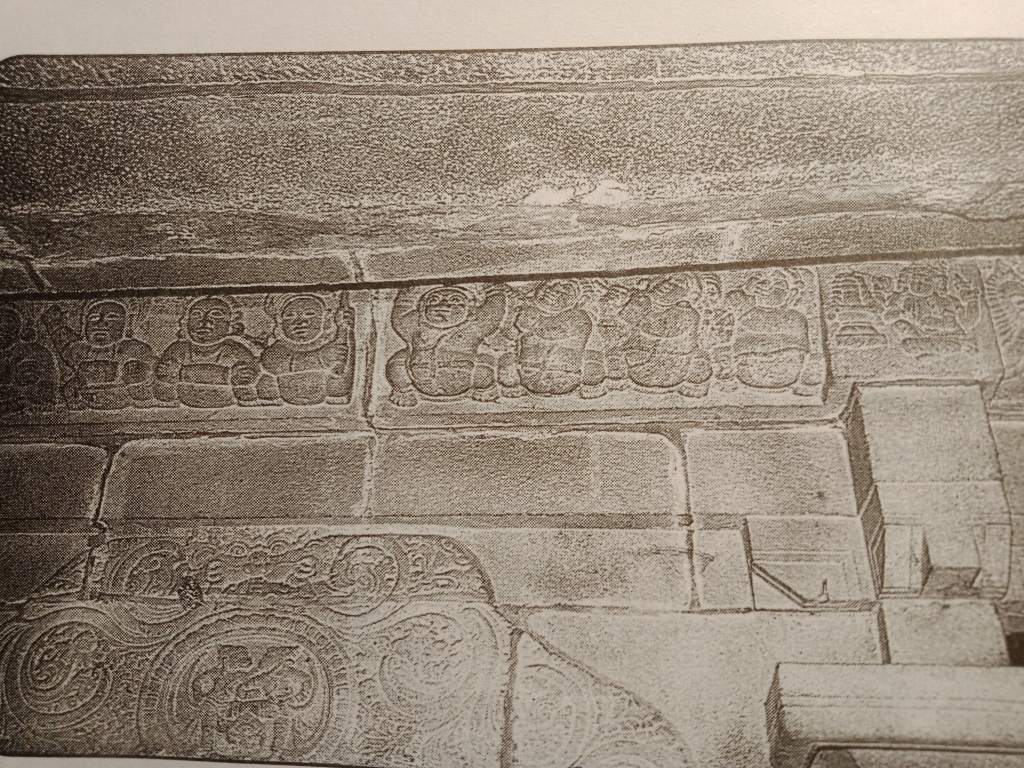
The base of the sanctum hosts the typical Chozha period features of a Jagathi, tripatta kumudha and padha varga (elements of a typical south Indian sanctum). These structures are fully inscribed with Kulothunka period inscriptions. On the walls of this chamber, pillar like structures are carved. These structures are shown connecting the base to the kodungai portion of the sanctum. The kodungai portion is decorated with a row of bootha gana(s).
The sanctum hosting the deity of Thirusoolanathar is the first structure built in this temple. Its structure and details remain unchanged from the period of Kulothunka till today.
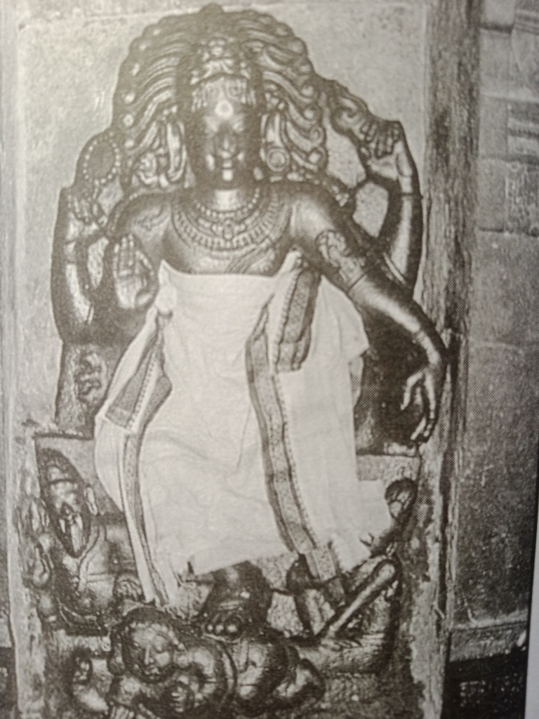
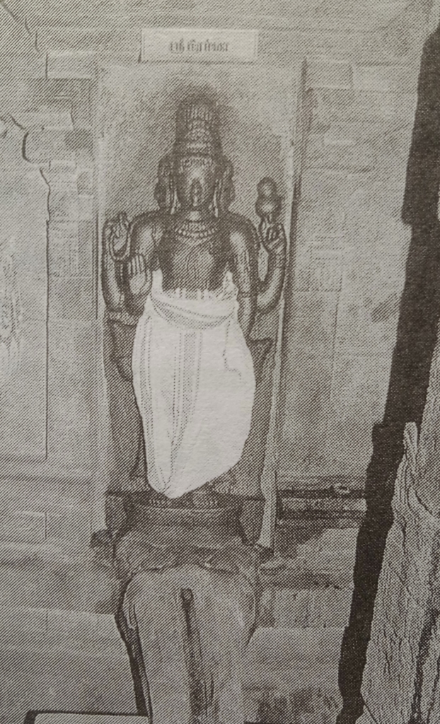
The walls of the sanctum host five deva koshta/deva kottam (cavities on the wall bearing images of deities), each bearing a sculpture of a deity and adorned by intricately carved makara thorana(s). Ganapathy and Dakshinamoorthy reside facing south, Lingothbavar stands alone facing west and Bhrama and Durga facing north.
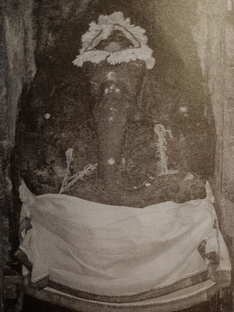
Deva Kottam: – 1, Direction South, Deity: – Naga Yagyopavitha Ganapathy: – A beautiful sculpture of Lord Ganapathy is placed in the first Deva Kottam facing South. He is depicted wearing a snake as his sacred thread, thus gaining the title “Naga Yagyopavitha Ganapathy”. The fine chisel work of its sculpture has infused a certain level of gracefulness into the face and posture of the sculpture.
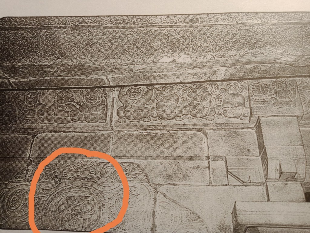
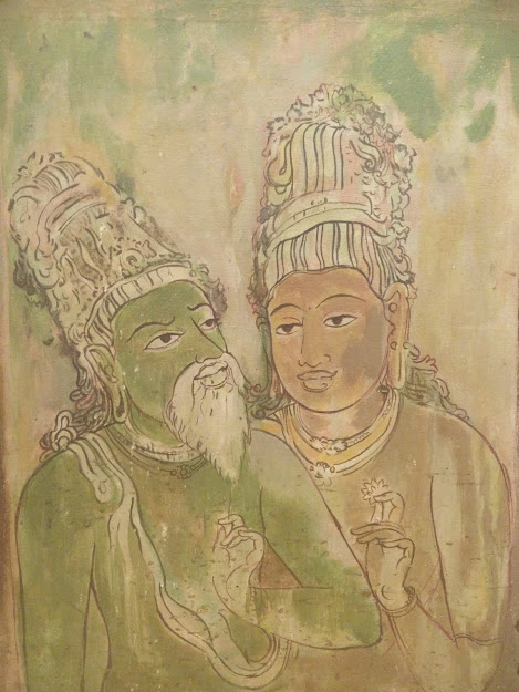
A delicately carved makarana thorna adds to the aesthetics of the kottam. In the central portion of the thorana, the episode of quarrel between Vali and Sugreeva is carved. In between the thorana and the kodungai portion of the vimana, Lord Bhrama is shown worshipping Lord Shiva. These sets of sculptures together narrate the sthalapurana of the Thirusoolanathar temple. Certain incidents from the life story of Kannappa Nayanar is also depicted.
Deva Kottam: – 2, Direction South, Deity: – Dakshinamoorthy: – Kulothunka period Dakshinamoorthy sculptures are a vast subject by itself. The craftsmen under his patronage seem to have mastered the techniques of repeatedly excelling in the creation of this iconography. Each sculpture is unique and displays in its own way, the skill of its maker. True to this legacy, the sculpture of Dakshinamoorty in the second kottam exhibits the capabilities of the sculptor and it meets the standards of set by its contemporaries. The deity is shown in a Veerasana posture. His right leg is placed on Muyalakan and his left leg is rested on the seat. His hand is supported by his left knee and his right hand is placed in the chinmudhra.
In the central portion of the Makara thorana, the image of somaskandha is carved.
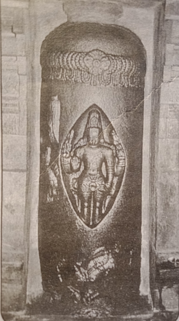
Deva Kottam: – 3, Direction west, Deity: – Lingothbavar: – The sculpture of Lingothbavar stands alone facing west. The iconography depicts Lord Shiva emerging out of a Lingam in his human form. The postures are neatly carved and hence the deity looks majestic.
More than the sculpture inside the kottam, the image in the central portion of the makarana thorana needs a special mention. Lord Shiva and his bull, rishabha are carved in the makarana thorana. Since the circular cavity in the center of the thorana is just a few centimeters in diameter, delicately carved sculptures with fine details cannot be created. Instead, mere outlines and rough markings can be made. This reduces the scope of sculpting to a great extent. Yet, these factors seem to have not discouraged the sculptor. Within the given space, the sculptor has successfully captured the physical features of the figures without compromising the overall look.
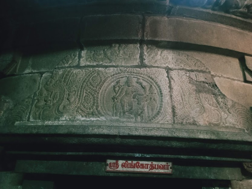
The showcasing of the male deity’s physique, the majestic look on his face, capturing the muscular body of the bull and the displaying of the gigantic size of the bull have all been achieved through great ease. Even this minute and hardly noticeable figure in the makara thorana showcases the skill and its mastery by the craftsmen under Kulothunka’s patronage.
Deva Kottam: – 4, Direction north, Deity: – Bhrama: – The connection between Bhrama and the Thirusoolanathar temple is clearly mentioned in the sthalapurana. Thus, several figures of this deity can be spotted in the temple premises. This particular sculpture in the deva kottam is the largest of them all. The male deity depicted with his four heads. The sculpture of Arthanari, is seen in the makarana thorana.
Deva Kottam: – 5, Direction: north, Deity: – Durga: – The fine sculpture of Goddess Durga is placed in the second deva kottam facing north. The episode of Kalinga Narthana (Krishna dancing on the serpent Kalinga) is seen in the makarana thorana. Between the thorna and the kodungai portion in the vimana, the sculpture of hanuman praying to lord Shiva can be spotted.
The current female deity in this temple is goddess Thripurasundhari, who stands facing south. However, goddess Ambika was the first female deity to be installed. The sculpture of the goddess was damaged and was replaced by the current female deity, Thripurasundhari. The reason for the damage seems unclear. The sculpture is still kept behind goddess Thripurasundhari and worshipped.
The sanctum hosting this deity is rectangular at the base and supports a sabhakara type of vimana on the top. There are four deva kottam, each hosting a sculpture of a deity and pillar like structure are carved on the walls.
The inner thiruchutru mandapa (circumambulatory path) hosts the sub-shrines of Ganapathy, Srinivasa, Muruga and Nalvar. The shrines of Ayyapa and Adi Shankara are situated in the outer thiruchutru. The pillars erecting these sculptures bear the figures of several iconographies from the Hindu mythology. Certain elements of a South Indian temple such as, a bali peedam, kodi maram, nandhi mandapam, navagraha mandapam and a arudhra mandapam are present in this temple.
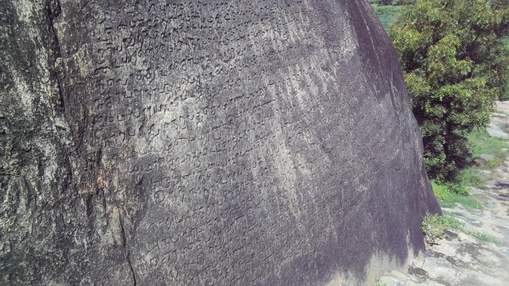
In the year 1901, under the Archeological Survey of India, this temple, its structures and its inscriptions were studied and documented. These documents were later published in the Vol 6 of Epigraphica Indica (1900-1901). According to these documents, 14 sets of inscriptions have been found inside the Thirusoolanathar temple complex. However, only five sets of inscriptions are seen in the temple today. Stones bearing Kulothunka period inscriptions regarding the town of Thirusoolam are found in the eastern sanctum wall of the Karpakambal shrine in the Kapaleeswarar temple, Mylapore, Chennai. Thus, we can infer that the stones of the Thirusoolam temple have been used for the construction of other monuments.
Details regarding the 14 sets of inscriptions of the Thirusoolanathar temple
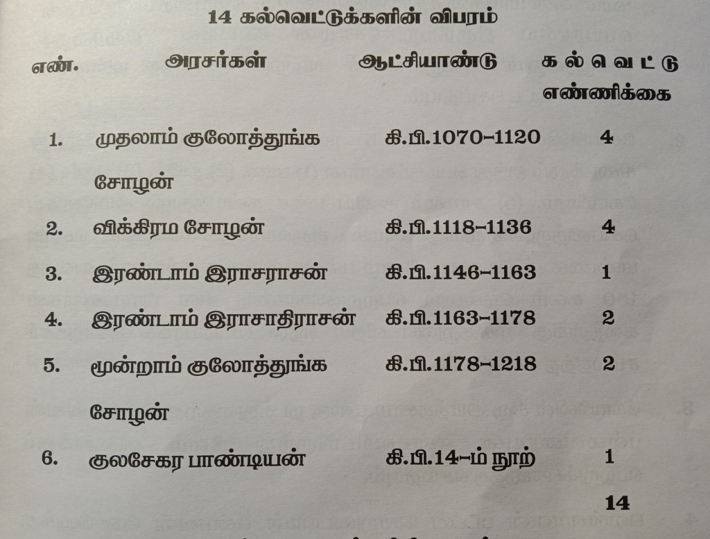
This has resulted in the misplacement of the temple’s inscriptions. The epigraphists have published a table regarding the details of the 14 inscriptions belonging to this temple.
The oldest of the 14 inscriptions are those inscribed during the reign of Kulothunka Chozha 1. There are a total of 4 sets of inscriptions dated back to his period. These are administrative inscriptions that mentions the government lands donated to this temple, details regarding the temple land in the town of Thirusoolam, public donations made to this temple, regulation of temple’s rituals and details regarding the exemption of taxes for the donations made to this temple.
Kulothunka Chozha 1 period inscriptions on the Southern sanctum wall of the Perumukkal temple
There are four sets of inscriptions dating back to the reign of Vikrama Chozha, the Chozha emperor succeeding Kulothunka, are part of the Thirusoolanathar temple inscriptions. Out of these, 1 inscription is severely degraded, making it impossible for epigraphists to decode the script. However the other two inscriptions talk about the registration of temple land bought from the locals and public donations to the temple.
Apart from these, there are two sets of inscriptions dating back to the reigns of Rajendhra Chozha 2, Kulothunka Chozha 3 and one inscription belonging to the period of Kulasekhara Pandya. These inscriptions dwell in detail the public donations to the temple, transaction of wealth and land between the temple and public and details regarding the exemption of taxes for these transactions.
These inscriptions give us an insight into the administrative units of measurement, administrative division of land, taxes, its types and exemptions,
As mentioned earlier, the main agendas of Kulothunka’s rule was to establish proper administration over the vast extents of the newly annexed Chozha territory. Thus, he drafted proper land division scales in order to ease the process of buying, selling and registering lands. The Kulothunka period inscriptions in the Thirusoolnathar temple infer to these land division scales.
The Jeyankonda Chozha mandalam refers to a specific region in the Chozha territory. It is divided into two kottam(s), the Puliyur Kottam and the Sembur Kottam. These kottam(s) were also classified as Rajendhra Chozha valanadu and Kulothunka chozha valanadu. These were further divided into nadu(s). Surathur nadu, Peeroor naadu, Puzhal nadu and Mangadu nadu were the nadu(s) under the Puliyur Kottam. Pallavapuram, Manarpakkam, Malaiyampakkam, Adambakkam, Kasavampakkam, Peeroor, Puzhal, Sembur, Thirumangalam, Manimangalam, Mangadu, Poondhamalli are 12 towns which constitute the Surathur naadu. All these details have been clearly mentioned in the land registration inscriptions of dating back to the Medieval Chozha period.
A Kulothunka Chozha 1 period inscription bearing details regarding measurement scales situated in the Perumukkal hillock
Scales for measuring land, weight, food grains, cattle and fluids such as oil, water, etc have been mentioned in the inscriptions of the Thrirusoolnathar temple. Over the years, the donation of lamps and cattle have been repeatedly mentioned in the inscriptions of this temple. Apart from these, there are references of donating food grains, utensils, material required for temple rituals and wealth.
The inscriptions mention the seven types of taxes which a citizen had to pay to the government for transaction of wealth, owning of property, owning of land, fencing of land, annul harvest, etc. These seven types of taxes are termed as Aalvari, Vetiya manji, Echoru, Kootrunel, Antharayam, Neervalai and Velikkasu. During certain circumstances, these taxes were exempted. The provisions for such exemptions are also listed down clearly.
The Thirusoolanathar temple and its structures that we see today, help us to deduce the Pallavaram that must have thrived during the time of its construction. The inscriptions and the sculptures in this temple are testimonies to the rich and significant human connection to the region of Pallavaram. The clear methods of documentation mentioned in the inscriptions must have taken long spans of time to evolve and reach this level of clarity and details. The sculptures showcase a high level of mastery in the repeated creation of such iconographies. Even these iconographies would have taken a long span of time to evolve and attain this level of excellence and nuances.
The vast timeline of Pallavaram indirectly represents this period of evolution of artforms, administrative methods and the socio-economic aspects of the human society. During certain periods, this evolution has attained a certain level of heights. The Paleolithic hand-axe, the Pallavan cave temple and the Thirusoolanathar temple are the outcomes of such heights. These monuments are like summits bearing flags symbolizing the greatness of its creators.
However, one thing remains unchanged throughout our journey in this timeline. The basic factors which have bound and enhanced the human connection with the regions in and around Pallavaram have not changed till today. The ability of this region to provide abundance of our fundamental resources has been the major factor which has made it possible for mankind to evolve, flourish and thrive at Pallavaram.
Our journey through vast extents of the Pallavaram timeline continues.. Our next stop is during the Colonial period when traders transformed into rulers.
Chatper 4: The Colonial Insight #
Introduction #
“Warfare” is a vast and fascinating subject. Not always it is a study of weapons, troops and mere field tactics. Even the movement and proper stationing of the troops, understanding the forces of nature and drafting tactics in accordance, are all various aspects under the subject “warfare”. It demands one’s deep knowledge about the topography, wind direction, visibility of the troops and other aspects that may impact and obstruct the battle tactics.
There are several records of instances in the past where small troops have won against mighty opponents just by implementing brilliant battle tactics. In order to draft and implement such tactics, a commander of such forces must require deep knowledge about the mentioned aspects.
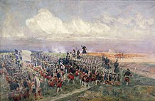
For instance, the British claim that they were able to win against the mighty Tipu Sultan in the fourth Anglo-Mysore war only after understanding the structure of the landscape at the battlefield at Srirangapatna. In other words, Hayder Ali and Tipu Sulthan were able to win the massive English troops thrice only by knowing better about the topography of the battlefield and the capabilities of the modern weapons used by the opponent.
An artist’s depiction of the battle of Indus. (The Mongolian invasion in India)
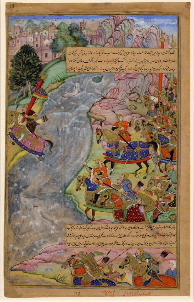
Earlier in the timeline, the Mongols were able to loot the Madurai Meenakshi Amman temple only after understanding the landscape structure of the Deccan and the effective methods to cross it. The Deccan plateaus which acted as a natural fortress for southern India, proved ineffective in front of the Mongolian horses and their knack of using them.
Thus the deep understanding of certain fundamental factors and implementing tactics in accordance are capable of giving immense power to a small troop of soldiers. Even in the setting up of forts and cantonments, these aspects play a vital role in deciding the location and structure. Each fort, cantonment, base camp is unique based on the opponents and natural factors it fights to prove itself effective.
The British Raj who ruled over India have established innumerable number of forts, cantonments and military settlements over the three-century span of their rule. These establishments have helped them in annexing several new provinces and vanquishing their rival European powers from their colonies in India. At the time of their arrival in this subcontinent, the French were their major rival. Often, clashes regarding colonies and exercise of powers led to several combats between the British and the French.
Both these sides made several arrangements in advance to face battles that might arouse any moment due to small clashes. The British cantonment at Pallavaram is one such arrangement. However, in the later years it served several vital roles in helping the British sustain and flourish at Madras. In this chapter we shall discuss about the natural factors that supported the cantonment at Pallavaram, the vital roles it played in establishing the British Raj at Chennai. We shall also talk about the first mines set up at Pallavaram and the course of events that has shaped the town which we experience today.
The Colonial Insight #
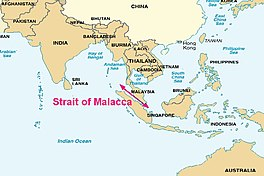
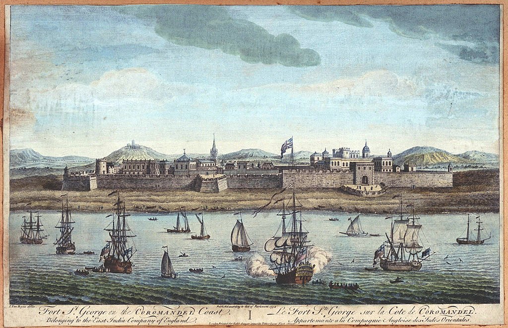
In the early 17th century, the British East India company (EIC) commenced its first licensed trade in the Indian subcontinent, in a town named Surat, situated in the present Indian state of Gujarat. In order to secure and sustain their dominance over the trade in India, they were looking for a port closer to the Malaccan Straits, a narrow stretch of sea between the islands of Malaysia and Sumatra. Closeness to the Malaccan Straits will make it easy for the British East India company to trade and commute with their colonies at America and the West Indies.
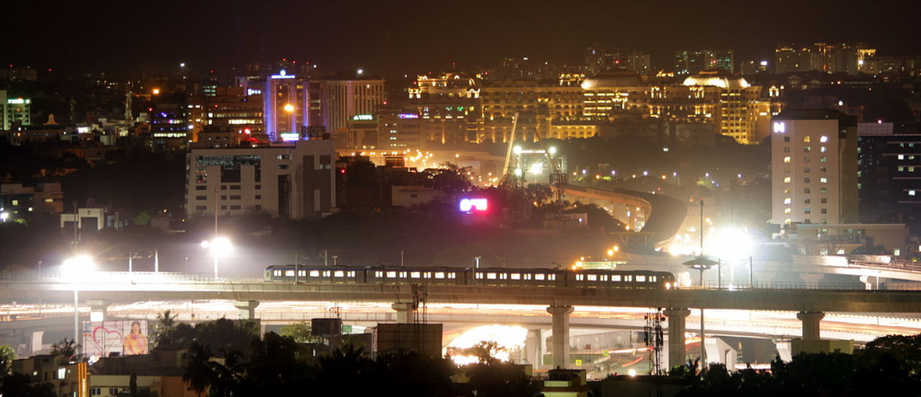
After a few months of probing, the company purchased a piece of coastal land in the banks of the river Cooum, in an area originally called Chennirayarpattinam. Today, the areas around this piece of land have grown into a massive metropolitan, widely known as the Chennai city, hosting a staggering 11 million human beings.
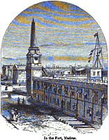
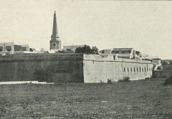
In the year 1639, the British East India company (EIC) completed the construction and inauguration of their first fortified settlement in the Indian subcontinent, the Fort St. George. The settlement consisted of a fort and a harbor. After the inauguration of this harbor, the British started trading across the Pacific. This harbor also helped them to commute to their colonies in the United States and the West Indies.
Subsequently, the Dutch and the Portuguese were gradually loosing their control over the trade in India. The French started evolving as the next dominant European power in India, following the British. They were attracted by the flourishing trade at Pondicherry, which eventually led to the establishment of the French settlements in and around this coastal town.
In the year 1665, news started spreading that the French were to inaugurate the French East India Company, which was to work with the motive of transforming the French into a dominant power in the trade in the East Indies. Once the word reached the British East India Company, immediate actions were taken to secure the Fort St. George and the George town that surrounded this fortified settlement. The fort was prepared for armed combat by enhancing its facilities and expanding the fortified campus.
The armed forces of the British East India company were split into several groups and were stationed at several cantonments in and around the George town in order to secure the fort and defend the incoming troops at times of armed clashes. One troop of such armed soldiers of the British EIC were stationed at the cantonment in Pallavaram.
The records of the British suggest that the cantonment at Pallavaram was situated 18 kilometers south of the fort and was expected to function as one of the major cantonments to secure the settlement at the George town. Several soldiers were stationed at the cantonment, as it was anticipated that any invasion by the French would occur from the south. In less than a few months, facilities necessary for Pallavaram to become the first major obstacle for the troops invading from the south were forged together. Soon, the cantonment started functioning in full-scale resulting in a group of soldiers permanently stationed there.
There are several factors which supported the EIC’s decision to institute a cantonment at Pallavaram. Its convenient distance from the fort and the considerable altitude are the two major factors. Apart from these, the abundantly available fundamental resources such as food and water enable this settlement to function independently at times of conflicts. The height provides an un-interrupted view of the surroundings giving adequate time to anticipate and encounter invasions. The considerably dense cover of forest canopy aids the soldiers to hide and attack, therefore, surprising the opponents. All these factors bound together made Pallavaram an ideal spot to establish a military settlement near the fort St. George.
Meanwhile, the French were also expanding their settlements in and around the coastal town of Pondicherry. The areas of Yanam, Mahe and Karikal were also successfully annexed by the French and several new cantonments were set up. Unlike the British cantonments, the French stationed their troops mostly at abandoned monuments in and around the town of Pondicherry. The famous Sengi fort neat Thiruvannamalai and the Perumukkal fort near Tindivanam are examples of French cantonments near Pondicherry.
Both these sides were constantly making innumerable arrangements to succeed in a battle which they were expecting any moment. Over the course of these events, several minor clashes aroused between the French and the British in India regarding rights over colonies, sea routes and exercise of powers. Even the the tensions of the French and the British clashes in Europe was reflected in India. Yet, none of it took the form of an armed battle as anticipated. During sparse occasions, the clashes between the French and the British resulted in arousing small-scale armed clashes. These clashes were immediately subsided by local administrators.
It took almost a century for the first armed combat to arise between the French and British in India, the Carnatic wars. The scale of the wars became much larger than expected earlier. Both the French and the British had established several allies with the local rulers. This resulted in considerable local interference in the battles fought. The troops of the local rulers also fought the wars alongside their respective allies. Three Carnatic wars were fought between the years 1744 – 1763.
The First Carnatic war (1744-1748) was fought at Adayar, at present a residential area situated on the southern banks of the river Adayar in the Chennai city and at Cuddalore, a coastal town along the Coramandel coast. For this brief period , the Fort St. George was under the control of the French. Thus, the cantonment at Pallavaram proved effective for the British to supply soldiers and arms to the battlefield at Adayar. During this period, several military settlements were established in and around the Pallavaram region. By this time, the facilities of the cantonment was sophisticated, helping the British EIC to sustain their control over the war.
The Second Carnatic war (1749-1754) was comparatively a much small-scaled battle. This can merely be considered as a period when armed conflicts between the allies of the European powers were prevalent. During this period, the British had regained their fortified settlement at Madras. The company and its allies, utilized this period to prepare their troops and supplies to encounter the French forces in India.
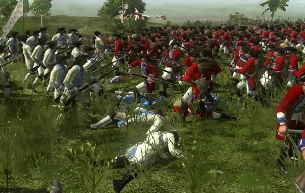
The Third Carnatic war (1756-1763), arguably the largest of the three wars, consisted of the battle of Wandiwash and armed conflicts at Bengal (a region in northeastern India). The British forces led by Sir Eyre Coote vanquished the French troops at Wandiwash (Vandavasi), which resulted in Pondicherry coming under the control of the British East India company. The war was concluded after signing the Treaty of Paris at France which made the British EIC to return Pondicherry to the French. The treaty agreed to permit the French have factories and trading units in India under the British East India Company’s administration.
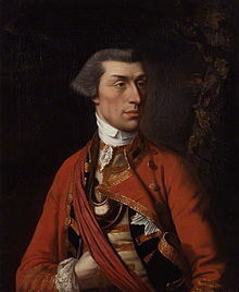
During the third Carnatic war, the Pallavaram cantonment acted as an obstacle to the French troops attempting to invade the fort St. George. Since the French troops were vanquished by the British troops at Vandavasi, the need to defend the fort was barely a concern. However, even after the war, the cantonment hosted a few military officials of the EIC who were posted there permanently. The cantonment continued to function till the end of the British rule in India in the year 1947.
The results of the Carnatic wars proved successful for the British East India company. The French were greatly vanquished and their settlements in India were restricted to the town of Pondicherry. The British East India company became the “solo” European power to dominate trade in the Indian subcontinent. The EIC gradually gained political authority resulting in India’s three century colonial rule.
During these 300 years, the cantonment at Pallavaram has played vital roles in shaping Madras as a major headquarter of the British empire in India. The cantonment gradually expanded in area and stretched between Pallavaram and St. Thomas Mount. Today, the Officers training academy, Alandur, the Military quarters, Meenanbakkam, the shooting grounds behind the Chennai airport are all remnants of British cantonment at Pallavaram. However, the colonial insights of Pallavaram do not end with the cantonment alone.
In the year 1767, the Survey of India was set up under the administration of the EIC, with a motive to map the vast extents of India. Several attempts were made to document the topography of India. Due to lack of proper equipment and inconsistent field work, most of these attempts were in vein and were insufficient to emerge as the physical map of India.
Only in the year 1802, the Survey of India launched the first major/large-scale project to map the vast landmasses of the Indian subcontinent. It was widely addressed as the Triangulation Survey, Trigonometrical Survey of India or the Great Indian arc. Proper equipment were sourced by the EIC in order to make precise measurements. Theodolites and sector-telescopes weighing several tons were shipped from England. British Infantry officer, William Lambton marked the first baseline for the Survey at the St. Thomas Mount, Madras for the Northern point and the Perumbakkam hill ( a small hillock situated in the outskirts of the present-day Chennai city ) for the Southern point. The area between this baseline became the first regions to enter the modern day maps of the Indian subcontinent. Thus, the Pallavaram hill was one of the earliest hillocks of India to be mapped in the modern documentation.
The Trignometrical Survey resulted in identifying the tallest peak in the world, the Mt. Everest. It also helped in documenting the landscape details of the Indian subcontinent and remains as the major base work for mapping India. The survey was conducted in several stages. In the renewal of each stage, several additions and corrections were made to the details that were documented. The availability of natural resources in the various regions of India was also documented in the later stages of the Trignometrical survey. Several sub-divisions were created under the Survey of India (The Archeological Survey, The Geological Survey, etc.) and India was thoroughly mapped and the regional details were clearly documented.
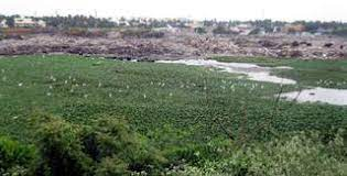
In the context of Pallavaram, the survey was instrumental in identifying the availability of Charnockite in the hills at Thirusoolam and Pallavaram. This resulted in setting up of the first mines at Pallavaram in order to extract this mineral and use it for constriction. Apart from mining, quarrying activities were also initiated in the Pallavaram region. From the mid 19th century till today, mining and quarrying activities at Pallavaram have continued to flourish. This has resulted in the conversion of several hillocks at Pallavaram into deep abandoned quarries. The hidden lake is one of such abandoned quarries at Pallavaram. Apart from these, several mines and quarries continue to function at Pallavaram.
The coincidental discovery of a Paleolithic hand-axe by Robert Bruce Foote is another sensational find by the Survey of India at Pallavaram. We have already spoken in details about this discovery in Chapter 1 : – The Story of the Stone. This event also surged the fame of Pallavaram amongst the European scholars. Thus, the human connection to the town of Pallavaram seems to have reflected greatly during the colonial period.
The colonial insights of Pallavaram confirms that, even during the last few centuries, we humans have had a significant connection with this region. The reason behind this remains unchanged from the Paleolithic times till today. Pallavaram is an area which offers us our basic needs in abundance, making it one of the ideal regions were mankind can flourish evolve and thrive.
Chapter 5: The Pity Present #
The history of Pallavaram has reached a point where, we as admirers are observing the flow of the timeline from a point where it takes a brief halt, the present. We as individuals who associate ourselves with the town are together weaving the future course of the timeline.
Looking back at our journey so far, Pallavaram has been an area where we humans have had a significant bonding from our earliest days on this planet. The town has nurtured and sheltered us in the various stages of our evolution. It has been an area where we gradually settled down as hunter-gatherer communities and have attained a stage where these regions are now part of a massive metropolitan.
As we observe keenly, the fundamental factor that has bound the significant connection between us and Pallavaram has remained unchanged till today. This region has been providing abundance of our fundamental needs. This pivotal factor has sustained the human settlements in Pallavaram for an innumerable span of time.
Over the last few centuries, the town has been in minds of the planners of the massive Metropolitan, the Chennai city. The availability of rich mineral sources and rocks for construction has benefited and continues to benefit the mining and quarrying industry. At present, most of the quarries that operate in the Pallavaram region are illegal and function without proper license or permission issued by the government. Many locals and activists have voiced their concern regarding this matter through articles in newspapers and magazines and filing cases in the High court of Chennai. However, none of these efforts have materialized to curb the activities of the quarries.
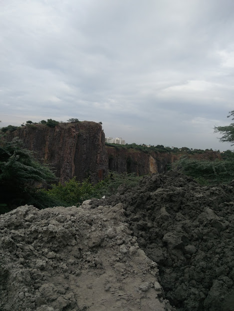
The centuries of quarrying in Pallavaram has resulted in causing two massive and deep lakes. Over the years, these lakes have consumed the lives of the locals and tourists who intentionally and unintentionally fall into it. These gigantic shallows in the landscape of Pallavaram were two hillocks in the past. They hosted dense forests which added to the greenery of this region.
The rapid pace of exploitive activities have depleted Pallavaram of its natural resources, which sustained human settlements in this region for several millenniums is now becoming scare. Pallavaram has witnessed a considerable fall in the ground water table and an alarming decrease in the quality of ground water. Apart from this, the mining and quarrying activities in this region have reduced the quality of the air and the silence of the surroundings.
The mushrooming educational institutions in this area have further encroached the forest lands. They also cause a large population of people to move in and out of region on a daily basis. Thus, the narrow streets of Pallavaram are always filled with an alarming number of vehicles seating people who are late to work or school. This adds to the considerable amount of noise pollution in this area.
Over the years, the area has witnessed an increasing number of gated communities and apartment complexes. This has resulted in the establishment and flourishing of several gated communities in this region. This has resulted in stacking a large population in an area which is struggling to sustain it due to lack of proper infrastructures and planning. The illegal mines and quarries that continue to operate in such a densely populated residential area remains a major threat to the locals and has reduced the quality of their lives to a great extent.
Every time we wander in the streets of Pallavaram to admire its historical significance and its rich human connection, we tend to wonder weather the town and its neighboring areas are currently undergoing the dark phase of its history.
However, on the positive side, one of the recent historical events in Pallavaram is the “Friday market”. A few hundred stalls are set up every Friday for the weekly market. The residents of Pallavaram take great pride in hosting the market every week. They claim that one can find any sort of product in this market. The types of stalls in the market are vast and very diverse. From essentials to electronics, provisions to pet stores, food stalls to furniture, the shops in the Friday market seem to leave out nothing.
Every Friday is like the god’s day at Pallavaram. Ask for anything and you will be given.
Thus, the Pallavaram experience today is filled with a large number of people who move in and out of the town on a daily basis. The activities of the illegal mines and quarries continue to dominate this region. The increasing number of educational institutions has resulted in the encroachment of forest lands. The practical odds in Pallavaram has negatively affected the residents of Pallavaram and has reduced their quality of life. Lack of proper infrastructure to regulate the flow of traffic has become a major problem in the recent years.
From the early 70s till today, Pallavaram seems to be undergoing the dark phase in its long and vast History. We as the occupants of the area, neighbors of this region, users of this town and admirers of its history are all the witnesses!
Conclusion #
History is a long rope of events that are braided together over time. The farther end of the rope is suspended in time at the point where we humans were created and began to occupy this planet. The other end of the rope is in the hands of each and everyone of us, who are the outcomes and makers of History. We stand at the present and weave tales that form the braids in the rope and extend it into the future. As a result, we too become part of that rope and understand the interconnected chain of events. These chains form timelines in History.
In this write-up we have attempted to understand and analyze the timeline of Pallavaram. The farther end began at the Paleolithic period and the course of events has paved its way to the present. The Paleolithic hand axe, Megalithic excavations, Pallavan cave temple, Chozha temple, colonial cantonments and the pitiful state of the town today are the various historically significant events that we have discussed about. These events are the major factors that have shaped the Pallavaram that we experience today.
However, we tend to forget that our actions today are responsible for sculpting the future. Such a historically significant town has been polluted and almost made inhabitable by our continious exploitative activities over the last few centuries. It is indeed very sorrowful to imagine the future course of events in this area.
We as contemporary human beings, are not just the witnesses of the fall of this town, but in many ways responsible for it too. Thus, we must take the responsibility to revive the lost glory of the town. We must immediately initiate the process of curbing our activities that tend to exploit and pollute the town. The future course of the town must be taken into serious consideration Plans and infrastructures must be drafted accordingly. The long rope of History will certainly help us in this process and shape the events that materialize a better future.
Credits
-
Proof read by: Mrs. Jayashree Ramkumar
-
Help and assistance: Mr. R.Nikhil Bharadwaaj
-
Special thanks to: Dr. Chandra Shekhar Balachandran